In this guide
- What Is a Site Plan for a Building Permit in Texas?
- Do You Need a Site Plan for a Permit in Texas?
- Complete Texas Site Plan Requirements Checklist
- Property Boundaries, Lot Dimensions, and Scale
- Existing and Proposed Buildings on the Site Plan
- Building Setbacks and Lot Coverage Requirements
- Easements, Rights-of-Way, and Property Restrictions
- Driveways, Access, and Parking Areas
- Utilities, Septic Systems, and Wells
- Floodplain, Drainage, and Grading Information
- Site Plan vs Property Survey: What’s the Difference?
- Residential vs Commercial Site Plan Requirements
- Example: Annotated Site Plan for a Detached Garage
- Common Reasons Texas Site Plans Get Rejected
- How to Prepare a Permit-Ready Site Plan in Texas
- Why Choose Site Plans TX for Permit Site Plans?
- Get Your Texas Permit Site Plan Prepared
- FAQ’s About Texas Site Plan Requirements
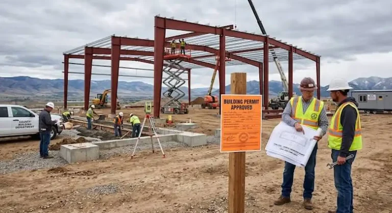
A building permit application can be delayed before the construction drawings are even reviewed if the site plan does not clearly show where the proposed work will take place. Whether you’re building a detached garage, adding a room, installing a swimming pool, or constructing a new home, the permitting authority may need a drawing that explains how the project fits on your property.
Understanding Texas site plan requirements can help you prepare the right information, avoid missing details, and reduce unnecessary revisions. A permit site plan is more than a sketch of your house and property lines. Depending on the project, it may need to show accurate dimensions, building setbacks, driveways, utilities, easements, drainage features, and other site conditions.
The exact requirements vary between Texas cities and counties. This guide explains what a site plan should generally include, how it differs from a survey, and what to check before submitting your permit application.
What Is a Site Plan for a Building Permit in Texas?
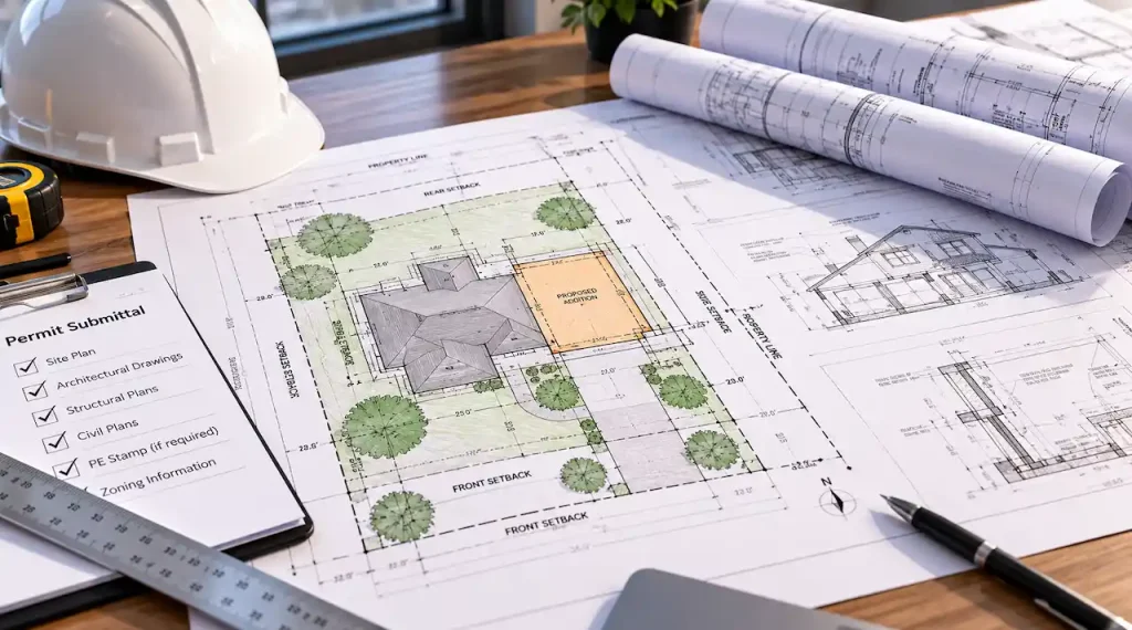
A site plan is a scaled drawing showing the layout of a property and the location of existing and proposed improvements. It allows the permitting authority to evaluate where construction will occur and whether the proposed layout satisfies applicable development requirements.
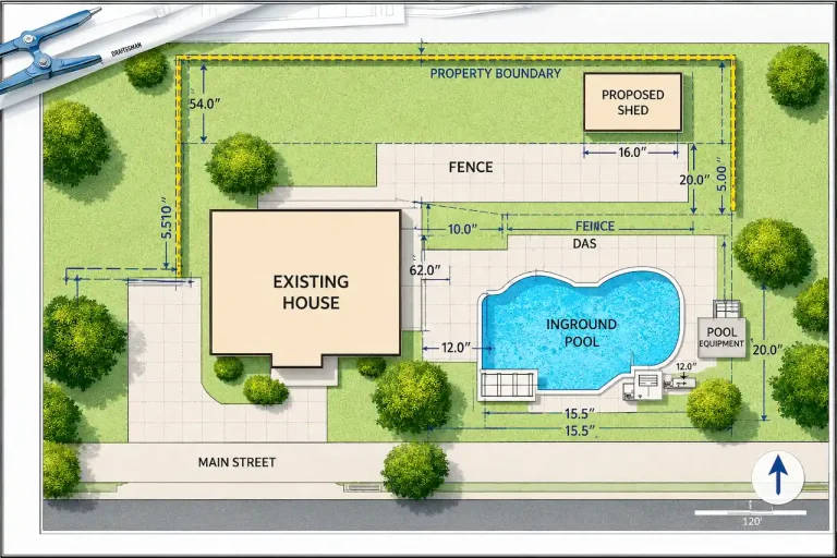
For example, a site plan for a detached garage may show the existing house, driveway, property boundaries, proposed garage footprint, and distances between the new structure and the lot lines.
A site plan for a home addition may also identify the existing building footprint, proposed expansion, nearby easements, and changes to impervious surfaces. The level of detail depends on the project. A small residential improvement may require a relatively simple drawing, while a commercial development may need extensive engineering and civil site information.
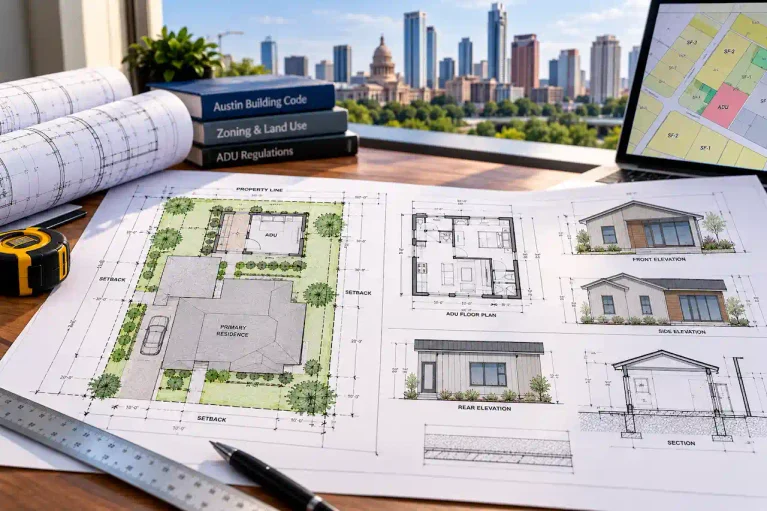
Our Texas site plan services help property owners prepare drawings based on the proposed work and applicable submission requirements.
Do You Need a Site Plan for a Permit in Texas?
Many Texas building permit applications require a site plan, especially when construction changes the property’s layout or introduces a new structure. However, there is no single statewide site plan checklist that applies to every city, county, and project. Municipalities may require site plans to review zoning, setbacks, building coverage, access, and other development standards.
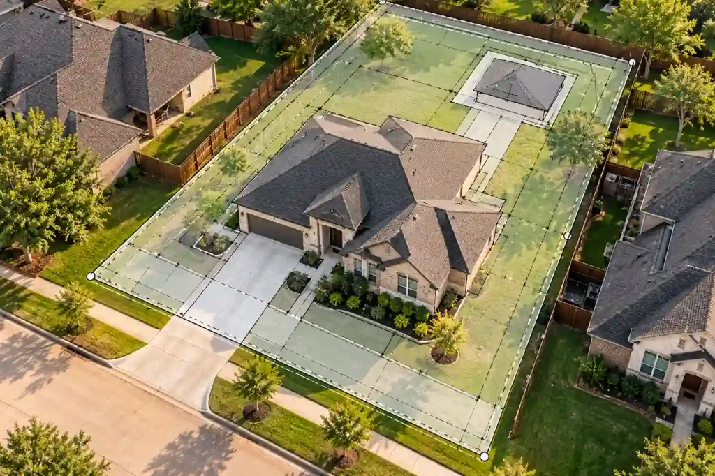
In unincorporated areas, site drawings may be requested for floodplain development, septic systems, driveway access, subdivision compliance, or other regulated activities. A site plan can also be useful when confirming whether a proposed building fits within the property’s available construction area.
Before commissioning drawings, request the current checklist from the responsible permitting authority and confirm the required scale, supporting documents, and level of detail.
Complete Texas Site Plan Requirements Checklist
A permit-ready site plan should communicate the property layout clearly enough for the reviewer to understand the proposed work. The following checklist covers the information commonly included in Texas residential site plans.
- Property boundaries, lot dimensions, and street frontage
- Property address, parcel identification, and north arrow
- Drawing scale and relevant dimension labels
- Existing buildings, driveways, patios, and other improvements
- Proposed building footprints and construction areas
- Required and proposed building setbacks
- Recorded easements and relevant rights-of-way
- Driveways, access points, and parking areas
- Utility connections and relevant service locations
- Drainage features, grading, or floodplain information where required
- Septic systems, wells, and required separation areas where applicable
- Impervious surface or lot coverage calculations when requested
Not every item applies to every project. The final site plan should follow the requirements of the applicable jurisdiction. For projects requiring a basic property layout, our Texas plot plan for permit services can help document the proposed improvements.
Property Boundaries, Lot Dimensions, and Scale
Property boundaries establish the legal limits of the lot. They are the starting point for measuring setbacks, positioning buildings, and identifying potential conflicts. A site plan should show the property shape and relevant dimensions using reliable source information.
Property Lines and Lot Measurements
Property line information may come from a current survey, recorded plat, or other acceptable property documentation. However, online parcel maps and approximate property records should not automatically be treated as survey-grade boundary evidence. Small boundary inaccuracies can become significant when a proposed garage, addition, or other structure is located close to a required setback.
If the available property information is unclear, a professional boundary survey may be necessary.
Drawing Scale and North Arrow
A site plan should use a consistent scale appropriate to the property’s size and the permitting authority’s requirements. The drawing should also include a north arrow and sufficient dimensions to make the layout understandable. An accurate scale helps reviewers assess the relationship between property boundaries, existing structures, and proposed construction.
A drawing that is visually attractive but not dimensionally reliable may still be unsuitable for permit review.
Existing and Proposed Buildings on the Site Plan
A complete site plan should distinguish between improvements that already exist and construction that is being proposed. This distinction helps reviewers identify the actual scope of work.
Existing Structures
Existing improvements may include the primary house, garage, sheds, decks, patios, swimming pools, and other permanent features relevant to the application. Their locations should be shown accurately enough to evaluate the proposed work.
Existing driveways, walkways, and paved areas may also be important when reviewing access or impervious cover.
Proposed Construction
The proposed improvement should be clearly labeled and dimensioned. For a detached garage, the site plan may identify the building footprint, its distance from property lines, and its relationship to the existing house. For a home addition, the drawing should show the existing building and the new area separately.
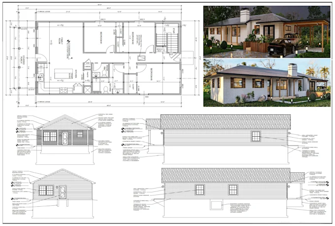
Projects requiring additional construction details may also need Texas residential permit plans covering architectural and structural work.
Building Setbacks and Lot Coverage Requirements
Setbacks and lot coverage are among the most important site plan considerations. A proposed building may fit physically within the property boundaries but still violate development restrictions.
Front, Rear, and Side Setbacks
Setbacks generally establish the required distance between a building and specified property boundaries or other regulated features. The applicable measurements depend on local regulations, zoning, property conditions, and structure type. A detached garage may have different placement rules from the primary residence. Corner lots and irregular parcels can also introduce additional considerations.
Site plans should show the applicable setback lines and the proposed building’s distance from the relevant boundaries.
Lot Coverage and Impervious Surfaces
Some Texas jurisdictions regulate the percentage of a lot that may be covered by buildings or impervious surfaces. Roofs, concrete driveways, patios, and other hard surfaces may affect these calculations. A project that increases building area can also change drainage conditions.
Our article on Williamson County impervious cover considerations discusses related planning issues.
Easements, Rights-of-Way, and Property Restrictions
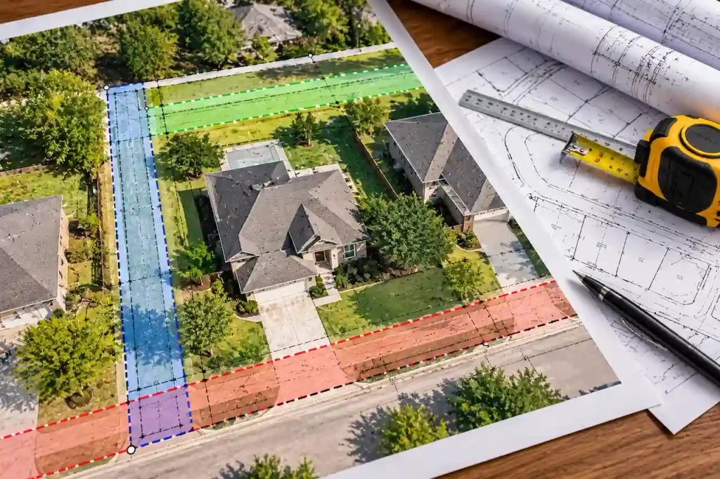
A site plan should identify easements and rights-of-way that could affect construction. Utility easements may contain underground or overhead infrastructure and can restrict the placement of permanent structures.
Drainage easements may need to remain accessible and unobstructed. A property owner should not assume that every open portion of the lot is available for building.
Why Easements Matter for Permits
If a proposed structure overlaps a recorded easement, the project may require relocation, additional authorization, or redesign. The exact implications depend on the easement terms and responsible authority. Showing easements early can prevent problems after construction materials have been ordered.
Deed Restrictions and Private Limitations
Government permitting rules are not the only restrictions that may affect a property. Recorded deed restrictions and homeowners association requirements can impose additional limitations on building placement, appearance, or use.
Our guide to deed restrictions versus zoning in Texas explains why these requirements should be reviewed separately.
Driveways, Access, and Parking Areas
Access information is especially important for new homes, detached garages, commercial developments, and projects that modify existing driveways. A site plan may need to show driveway width, location, connection to the street, and relationship to the proposed building.
For a detached garage, the drawing should make it clear how vehicles will reach the garage doors. For a new residence, access requirements may also involve emergency vehicles or other site-specific considerations.
If construction requires a new driveway connection to a public road, a separate access or driveway permit may be necessary. Our Texas garage and carport site plan services help document building placement and access arrangements for accessory structures.
Utilities, Septic Systems, and Wells
Utilities can affect where a new building may be located. Water lines, sewer connections, electrical service, gas lines, and other infrastructure may need to be identified on the site plan when relevant to the proposed work.
Water, Sewer, and Electrical Connections
A new home or commercial building may require utility service planning as part of the permit process. A home addition or detached workshop may need to show changes to existing connections. Utility easements and service routes should be coordinated with the proposed foundation and building footprint.
Septic Systems and Private Wells
Properties without municipal sewer service may rely on an on-site sewage facility. The septic system’s location, disposal area, and applicable separation distances can influence where new structures are allowed. Private wells may introduce additional separation and access considerations.
A site plan should reflect these features where required, particularly for rural residential development.
Floodplain, Drainage, and Grading Information
Floodplain and drainage conditions can introduce additional permit requirements. A property located within a regulated floodplain may need development authorization, elevation information, or other documentation before construction begins. Site plans may also need to show drainage patterns, grading changes, or proposed stormwater management features.
Floodplain Information
If a proposed building is located in or near a regulated floodplain, the permitting authority may request additional information. A standard property layout drawing does not replace a required floodplain study or engineering analysis.
Our guide to New Braunfels floodplain requirements covers related considerations.
Grading and Drainage Changes
Adding a building, driveway, or large paved surface can change how rainwater moves across a lot. Where required, the site plan should show relevant grading information or identify the need for additional drainage drawings. Drainage requirements can be especially important for commercial construction and larger residential developments.
Site Plan vs Property Survey: What’s the Difference?
A site plan and a boundary survey serve different purposes. A survey establishes property boundary information and other surveyed features through professional surveying methods. A site plan uses appropriate property information to show existing conditions and proposed improvements for planning or permit review.
| Site plan | Property survey |
|---|---|
| Shows proposed construction | Establishes surveyed property information |
| Identifies building placement | Documents boundaries and surveyed features |
| Includes setbacks and layout | Provides survey measurements |
| Supports permit applications | Supports boundary and property verification |
| May be drafted from reliable source documents | Must be prepared under applicable surveying requirements |
A site plan does not automatically replace a boundary survey. Some jurisdictions accept site plans prepared using existing surveys, while others require updated survey information. The appropriate document depends on the project and the permitting authority’s requirements.
Residential vs Commercial Site Plan Requirements
Residential site plans often focus on building placement, setbacks, driveways, utilities, and other property features.
Commercial projects may require substantially more information. A commercial site plan can involve parking layouts, accessible routes, fire access, landscaping, drainage, utility infrastructure, and other development requirements. Larger commercial projects may also require civil engineering and additional technical documentation.
Our Texas commercial site plan services support the preparation of drawings for qualifying commercial projects.
Example: Annotated Site Plan for a Detached Garage
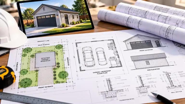
Consider a hypothetical property owner planning a 24-by-30-foot detached garage behind an existing house. The site plan must communicate more than the garage’s dimensions. It should identify the property boundaries, existing residence, proposed garage, access route, relevant easements, and applicable setbacks.
| Site plan label | Information shown |
|---|---|
| A — Property boundary | Lot shape and dimensions |
| B — Existing residence | Current house footprint |
| C — Proposed garage | New building footprint and dimensions |
| D — Setback lines | Required building clearances |
| E — Easement | Recorded utility or drainage area |
| F — Driveway | Proposed vehicle access |
| G — North arrow | Drawing orientation |
This is an illustrative drawing checklist rather than a completed client project. If the proposed garage conflicts with an easement or setback, the placement should be revised before construction begins.
Common Reasons Texas Site Plans Get Rejected
A site plan may be returned for corrections when important information is missing or inconsistent. Common issues include inaccurate property dimensions, missing setback measurements, unclear building footprints, and unmarked easements.
Applications may also lack drainage information, utility details, or supporting surveys when those documents are required. A drawing that does not match the dimensions shown on the architectural plans can create additional review questions.
Our guide to common Texas site plan rejection reasons explains how to identify and address these problems.
How to Prepare a Permit-Ready Site Plan in Texas
The most effective approach is to begin with reliable property information and the correct jurisdiction’s submission requirements. Start by identifying the project location and determining whether the property falls inside city limits or an unincorporated county area. Next, gather the available survey, recorded plat, property dimensions, existing building information, and proposed construction details.
Confirm the relevant setbacks, easements, access requirements, and any site-specific restrictions. Prepare the site plan using a consistent scale and clear labels. Make sure the proposed building footprint matches the dimensions in the construction drawings.
Before submission, compare the completed drawing with the permitting authority’s current checklist.
For projects requiring more than a site plan, our Texas full permit drawing sets can help coordinate the broader construction documentation.
Why Choose Site Plans TX for Permit Site Plans?
Site Plans TX helps Texas homeowners, contractors, and property owners prepare clear site plans for residential and commercial permit applications. Our services include property layout drawings for new homes, additions, garages, decks, pools, and other improvements.
We focus on documenting the proposed construction, relevant property conditions, and the information requested by the permitting authority.
Whether your project requires a simple plot plan or a more detailed permit drawing package, our goal is to make the documentation easier to understand and submit.
Get Your Texas Permit Site Plan Prepared
Planning a new home, garage, addition, deck, swimming pool, or commercial improvement?
Site Plans TX can help prepare a clear, coordinated site plan showing your property’s existing conditions, proposed construction, setbacks, access, and other relevant features. Share your property location, available survey or plot information, and proposed project details so the drawing requirements can be identified before submission.
Contact Site Plans TX to discuss your project and request a site plan quote.
FAQ’s About Texas Site Plan Requirements
1. What must be included in a Texas site plan?
A typical site plan may include property boundaries, lot dimensions, existing structures, proposed construction, setbacks, driveways, easements, and relevant utilities. Additional information depends on the project and jurisdiction.
2. Is a site plan required for every building permit in Texas?
No. Requirements vary by jurisdiction and type of work. Site plans are commonly required when construction changes building placement, property access, or other site conditions.
3. Can I draw my own site plan for a permit?
Some jurisdictions accept owner-prepared site plans for certain projects if they meet submission standards. Others require professional documentation or additional survey and engineering information.
4. Does a Texas site plan need to be to scale?
Permit site plans commonly need to be drawn to an acceptable scale, with accurate dimensions and clear labels. The specific scale should follow the responsible authority’s requirements.
5. Is a site plan the same as a property survey?
No. A survey establishes surveyed property information, while a site plan illustrates existing and proposed improvements. A site plan should not be represented as a professional boundary survey.
6. Do I need a new survey to prepare a site plan?
Not always. Some projects can use an acceptable existing survey or other reliable property information. A new survey may be necessary when boundaries are uncertain or the jurisdiction requires updated documentation.
7. Do site plans need to show utilities?
Utilities should be shown when relevant to the project or required by the permitting authority. New homes, additions, rural developments, and commercial projects may require more extensive utility information.
8. Do Texas site plans need drainage information?
Some projects require grading, drainage, or floodplain information. The need depends on the property conditions, construction scope, and local regulations.
9. Can a site plan be rejected because of setbacks?
Yes. A proposed building that violates applicable setbacks or lacks sufficient setback information may receive correction comments or be denied approval.
10. Can Site Plans TX prepare site plans for different Texas cities?
Site Plans TX provides site plan drafting services for projects across Texas. The drawing requirements should be confirmed for the specific property and permitting authority.
- Commercial Tenant Improvement Plans in Texas: Change of Use, ADA, Life Safety & MEP
- Texas Home Addition Permit Plans: Site, Foundation, Framing & MEP
- Do Texas Permit Drawings Need a PE Stamp?
- Texas Site Plan Requirements: What Must Be Shown for a Permit?
- Detached Garage & Workshop Permit Plans in Texas

Engineer Wasim
I have been preparing permit drawings since 2015, across residential, commercial, structural, site plan and engineering coordination projects. Site Plans TX focuses that experience on Texas permit rules and local review criteria.