Austin Site Plans: Planning a development projects involves more than drawing the location of a building on a property. A site plan must demonstrate how the proposed development fits within the City’s Land Development Code (LDC), environmental requirements, transportation standards, drainage rules, and other applicable regulations.
Austin’s Land Development Code, including Titles 25-1 through 25-13, establishes development regulations within the City’s planning and zoning jurisdiction. Chapter 25-5 specifically addresses site plans, while other chapters cover zoning, subdivision, transportation, environmental protection, and related requirements.
For property owners, builders, developers, architects, engineers, and contractors, understanding these requirements before preparing a site plan can reduce corrections and prevent avoidable delays during review. Three areas deserve particular attention: impervious cover, watershed requirements, and heritage or protected trees.
What Is an Austin Site Plan?
An Austin site plan is a detailed drawing that shows existing and proposed improvements on a property. It can identify buildings, parking areas, driveways, landscaping, drainage improvements, utility features, detention facilities, and other site elements.
The City of Austin reviews site plans for compliance with requirements involving zoning, design standards, drainage and floodplains, water quality, transportation, environmental protection, erosion control, and tree mitigation or protection.
A site plan application is therefore more than an architectural drawing. It is a development document that brings together information from several regulatory areas. Depending on the project, the plan may need to show property boundaries, existing and proposed structures, building setbacks, parking, access roads, floodplains, drainage features, landscaping, tree protection areas, and impervious cover calculations.
How LDC Title 25 Affects Site Plans
Austin’s LDC determines how land can be used, what can be built, where development can occur, and how much development is allowed on a property. Title 25 includes separate chapters that address different parts of the development process. Chapter 25-5 addresses site plans, while other portions of the code address zoning, subdivision, transportation, environmental requirements, and building-related regulations.
This means a site plan cannot be prepared by looking at only one section of the code. A project may need to satisfy several requirements at the same time. For example, a proposed building may fit within the property’s available area but still require changes because of impervious cover limits, a protected tree, a drainage feature, a floodplain, required parking, or a building setback.
What Every Austin Site Plan Application Needs
The exact documents depend on the project, but Austin’s consolidated site plan requirements provide a detailed framework for what applicants may need to submit. Basic application information can include the property’s legal description, tax certificate, ownership information, project address, site location map, related case numbers, required signatures, and other project information. The plan set also needs standard information such as the project title, north arrow, engineering scale, designer information, property boundaries, and other required notes.
The City also requires specific information to be shown within the plan set, including proposed and allowed floor area ratio, impervious cover percentage and square footage, building coverage, unit count, building height, gross floor area, and other project-specific information. This is why preparing a site plan only after the architectural design is finished can create problems. Development constraints should be evaluated during the design process rather than treated as an afterthought.
Impervious Cover: One of the Most Important Calculations
Impervious cover is a major consideration in Austin development. Impervious surfaces are areas that prevent or significantly reduce water from soaking into the ground. Depending on the project, these can include buildings, paved areas, parking, driveways, sidewalks, and other constructed surfaces. Austin requires the site plan data table to identify the proposed impervious cover percentage and total square footage. This calculation matters because increasing impervious surfaces can change how stormwater moves across a property.
For example, adding a large parking area or expanding a driveway may increase the site’s impervious cover even if the building itself remains relatively small. Before finalizing the design, the applicant should calculate the total impervious area and compare it with the applicable requirements for the property.
Why Impervious Cover Matters
Impervious cover is closely connected to Austin’s broader watershed protection system. When rain falls on natural ground, some water can infiltrate into the soil. When large portions of a site are covered with concrete, asphalt, roofs, or other impervious materials, more runoff may be generated. That runoff can affect drainage systems, waterways, erosion, and water quality.
For this reason, impervious cover should be considered during the early site layout stage. Moving a building, reducing pavement, changing parking arrangements, or preserving natural areas can sometimes affect the overall development design.
Watershed Requirements in Austin
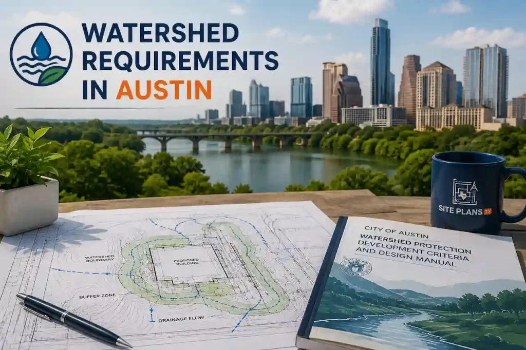
The watershed where a property is located can significantly influence the site plan review process. Austin’s site plan application requirements call for the project to identify the watershed and its classification and state whether the project is subject to or exempt from the Watershed Protection Regulations.
The application may also need to explain how stormwater runoff will be handled, including drainage easements, channels, curb inlets, storm sewers, detention, sedimentation and filtration ponds, and water quality controls. This means two properties with similar sizes and proposed buildings can have different development requirements because they are located in different environmental or watershed conditions.
What Is Checked During Watershed Review?
Depending on the property, Austin’s environmental review can involve several items. These may include:
- Watershed classification
- Stormwater runoff
- Drainage patterns
- Water quality
- Floodplain boundaries
- Critical Water Quality Zones
- Water Quality Transition Zones
- Critical Environmental Features
- Erosion and sedimentation controls
- Environmental Resource Inventory
- Grading
- Slope conditions
- Stormwater pollution prevention
Austin’s site plan requirements state that an Environmental Resource Inventory may be required for sites within the Edwards Aquifer Recharge Zone, sites containing a Critical Water Quality Zone, sites with gradients greater than 15%, or sites containing or located within 150 feet of certain wetland features. These requirements demonstrate why environmental conditions should be identified before the site plan is finalized.
Heritage and Protected Trees
Trees are another major consideration in Austin site planning. The City’s development review process includes mitigation and protection requirements for protected and heritage trees. A tree that appears to be outside the proposed building footprint can still affect a project if its critical root zone reaches the limits of construction.
Austin’s current site plan requirements call for a tree survey for trees 8 inches in diameter or larger within the limits of construction or with critical root zones touching those limits. The City also requires a tree protection plan under the applicable Land Development Code provisions. This makes tree information an important part of early site analysis.
Why Tree Surveys Matter
A common mistake is designing the building and parking layout first and checking trees afterward. If a protected or heritage tree is discovered after the site has already been designed, the applicant may need to relocate structures, adjust grading, change access, modify utilities, or redesign other site elements.
The City’s code also provides for review and potential mitigation when protected trees are proposed for removal. The applicable tree protection provisions require development applications to include grading and tree protection information and address preservation of the natural character of the landscape. For this reason, a tree survey should be considered an early planning requirement rather than a final checklist item.
Floodplain and Drainage Requirements
Floodplain conditions can also affect an Austin site plan. The City’s requirements can include identifying FEMA floodplains, fully developed floodplains, drainage easements, stormwater infrastructure, and finished floor elevations. Certain projects may also require a floodplain study prepared and sealed by an appropriate professional.
The site plan should clearly show applicable drainage features and floodplain boundaries. This information can influence building placement, parking areas, grading, access, and drainage design. A site that looks suitable for development from a property boundary perspective may therefore have a much smaller practical development area once floodplain and drainage constraints are considered.
What Should Be Shown on the Plan Set?
Austin’s requirements include extensive information that must be represented on the site plan. Depending on the project, this can include:
- Property boundaries and dimensions
- Existing and proposed buildings
- Building setbacks
- Building heights
- Parking areas
- Driveways
- Access roads
- Sidewalks
- Landscaping
- Trees and tree protection areas
- Drainage features
- Floodplains
- Watercourses
- Easements
- Utility features
- Loading areas
- Trash collection areas
- Outdoor storage
- Mechanical equipment
- Site amenities
- Impervious cover calculations
The City also requires information about existing land uses on adjoining properties and the location of buildings within 50 feet of the site. The purpose is to allow reviewers to understand how the proposed development relates to both the property and its surrounding area.
Common Reasons Austin Site Plans Need Corrections
Many site plan corrections happen because information is missing, inconsistent, or does not match the applicable requirements. Common issues include incorrect property information, incomplete dimensions, missing environmental information, incorrect impervious cover calculations, incomplete tree documentation, and drainage information that does not adequately address site conditions.
Another issue is using required notes incorrectly. Austin’s site plan requirements state that standard notes and signature blocks must be included and that changing required text can result in an application rejection. Applicants should therefore use the current City requirements and templates rather than relying on an older plan set from another project.
How to Prepare an Austin Site Plan Application
A more efficient approach is to review the property before developing the final site layout.
1. Confirm the Property Information
Verify the address, legal description, property boundaries, ownership information, and existing plat information.
2. Identify the Applicable Regulations
Determine the zoning, watershed classification, environmental conditions, transportation requirements, and other regulations that apply to the property.
3. Review Environmental Constraints
Check floodplains, watercourses, Critical Environmental Features, Critical Water Quality Zones, slopes, wetlands, and other environmental conditions.
4. Complete the Tree Analysis
Identify applicable trees and determine whether protected or heritage trees could affect the proposed limits of construction.
5. Calculate Impervious Cover
Calculate the proposed building, pavement, parking, driveway, sidewalk, and other applicable impervious areas.
6. Develop the Site Layout
Position buildings, parking, access, landscaping, drainage improvements, and other improvements while accounting for the identified constraints.
7. Prepare the Required Plan Set
Include the required drawings, notes, calculations, signatures, environmental documents, and supporting information.
8. Review Before Submission
Compare the complete plan set against the current City checklist and applicable LDC requirements before submitting the application.
Final Thoughts
An Austin site plan is not simply a drawing showing where a building will be located. It is a detailed development document that must demonstrate compliance with multiple parts of Austin’s Land Development Code and related regulations.
Impervious cover, watershed conditions, drainage, and protected or heritage trees can all influence the design of a project. Identifying these issues early can help property owners and developers avoid redesigns and unnecessary review cycles.
The best approach is to analyze the property before finalizing the site layout. Confirm the applicable LDC requirements, evaluate environmental conditions, complete the required tree analysis, calculate impervious cover, and prepare the plan using the City’s current application requirements. Austin’s Development Services Department provides the current site plan requirements and application guidance, and applicants should verify the rules that apply to their specific property and project before submitting.
Frequently Asked Questions About Austin Site Plans
1. What is an Austin site plan?
An Austin site plan is a detailed drawing showing existing and proposed improvements on a property, including buildings, parking, driveways, landscaping, drainage, utilities, and other site features. The City reviews site plans for compliance with applicable development regulations.
2. What is LDC Title 25 in Austin?
Title 25 is Austin’s Land Development Code, which contains development regulations covering areas such as zoning, subdivision, site plans, transportation, environmental protection, and other land development requirements.
3. What is impervious cover?
Impervious cover refers to constructed surfaces that prevent or reduce water from infiltrating into the ground. Austin site plan applications require the proposed impervious cover percentage and square footage to be identified in the plan data.
4. Why does the watershed matter for an Austin site plan?
The property’s watershed classification can affect stormwater, water quality, drainage, and environmental requirements. The site plan application must identify the watershed and indicate whether the project is subject to or exempt from applicable Watershed Protection Regulations.
5. Are trees required to be shown on an Austin site plan?
Depending on the project, tree surveys and tree protection plans may be required. Austin’s site plan requirements identify trees 8 inches or larger within the limits of construction or with critical root zones touching those limits for tree survey purposes.
6. What environmental information may be required?
Depending on site conditions, an application may require an Environmental Resource Inventory, erosion and sedimentation controls, watershed information, floodplain delineation, Critical Environmental Feature information, grading plans, tree protection plans, and other environmental documentation.
7. Does every Austin project require a site plan?
Not every project follows the same site plan process. Austin provides specific exemptions and requirements depending on the type of work and property. Non-residential site work or changes in zoning use generally require a site plan unless the project qualifies for an applicable exemption.
8. What can cause an Austin site plan application to be rejected?
Applications can require correction when required information is missing, inconsistent, inaccurate, or does not comply with current requirements. Issues can involve property information, impervious cover, environmental documentation, tree protection, drainage, required notes, dimensions, or other plan details.
9. Can a protected tree affect building placement?
Yes. A protected or heritage tree and its critical root zone can affect the limits of construction and overall site layout. Tree protection and potential mitigation requirements should therefore be considered during the initial design stage.
10. Where can I find Austin’s current site plan requirements?
The City of Austin Development Services Department publishes the current site plan application instructions and consolidated submittal requirements. Applicants should use the current City resources because development regulations and application procedures can change.